London
 UK
UK Ireland
 Scotland

Neonex Digital Ltd
Address
Nationwide Coverage
About Neonex Digital Ltd
Neonex Digital delivers high-precision 3D laser scanning and modelling services for the built environment. From commercial buildings and plant rooms to high-rise developments, our team supports architects, MEP consultants, and contractors with accurate as-built data and 3D Revit models for design, coordination, and retrofit works.
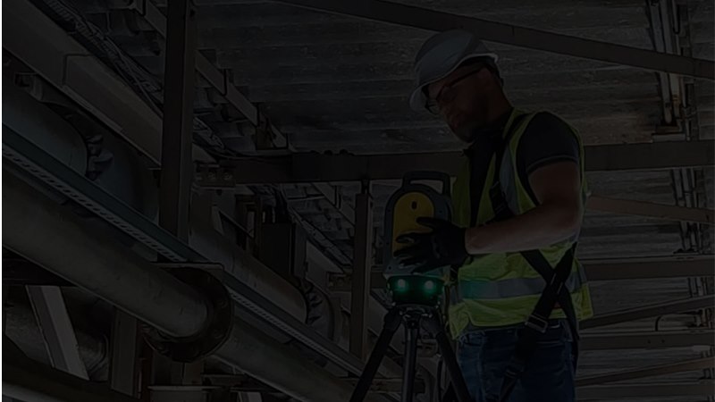
With a background in the complex demands of the Oil & Gas sector, we bring the same level of precision, safety, and attention to detail to construction and building projects. Our experienced team combines traditional survey expertise with modern scanning technology to produce deliverables including 3D point clouds, BIM-ready models, and detailed layout information.
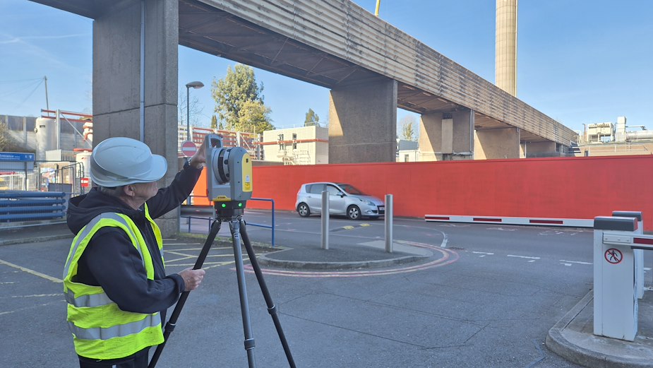
We’ve completed measured surveys for a wide range of environments – from city-centre offices to confined plantrooms and rooftops – all backed by clear RAMS, CCNSG-certified personnel, and years of industry knowledge.
Whether you're planning an upgrade, validating existing documentation, or looking for reliable as-built data, Neonex Digital provides a dependable, experienced partner for your project.
Services
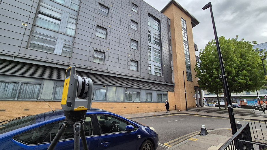
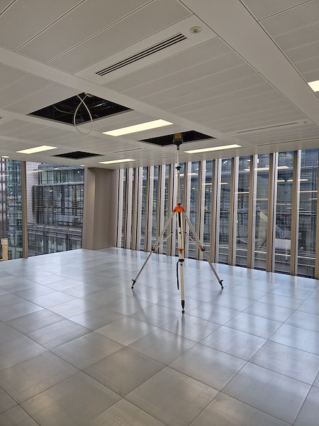
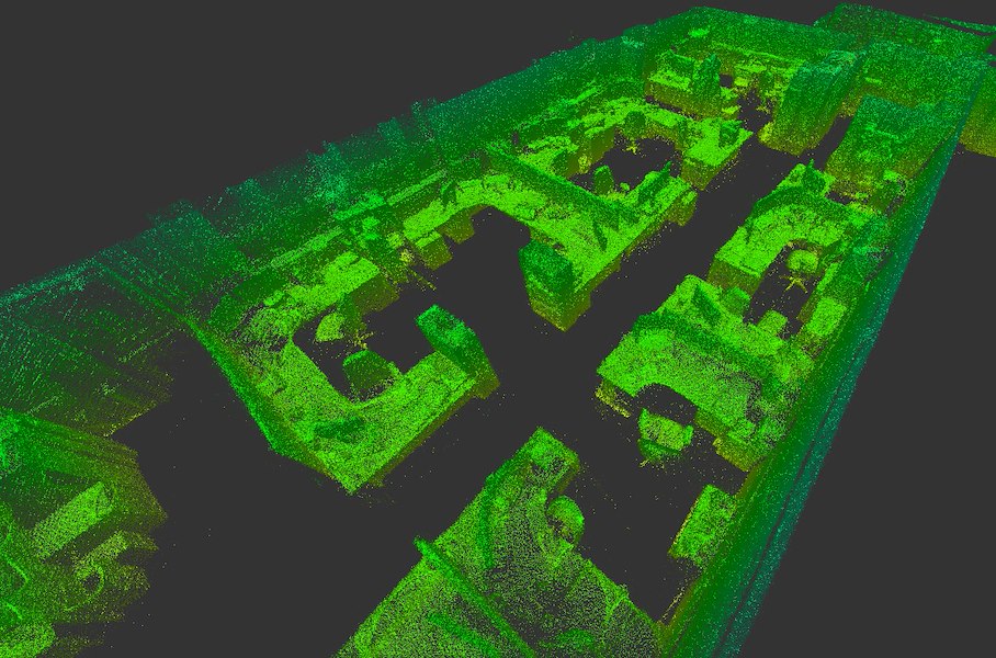
3D Laser Scanning
- Terrestrial 3D Laser Scanning
- Lidar and SLAM
- Drone Surveys
Survey Deliverables
- 3D Revit Models
Accurate, clash-ready BIM models built directly from point cloud data. Ideal for refurbishment, coordination, or MEP design integration.
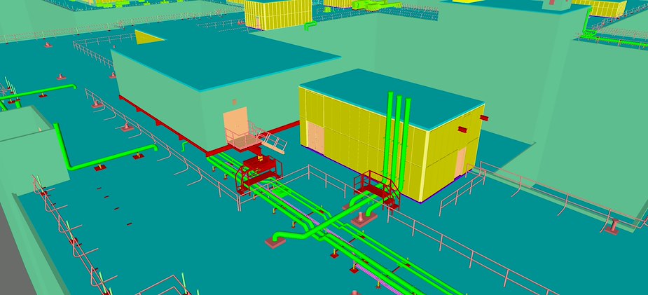
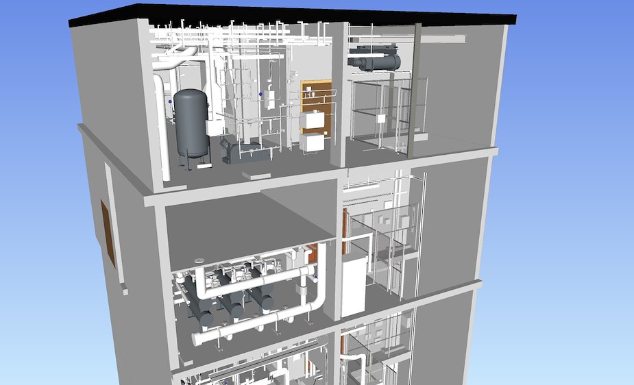
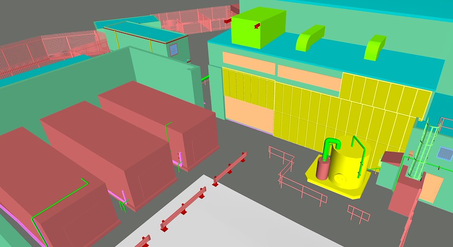
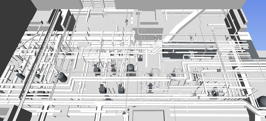
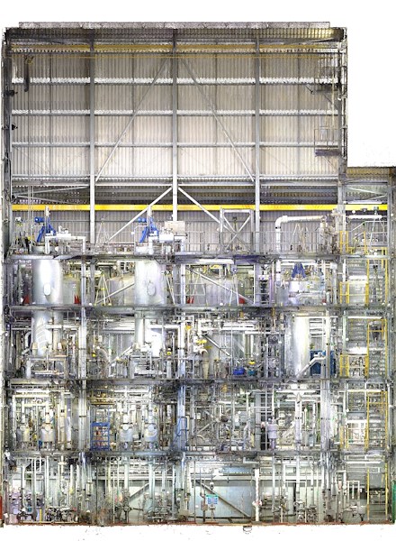
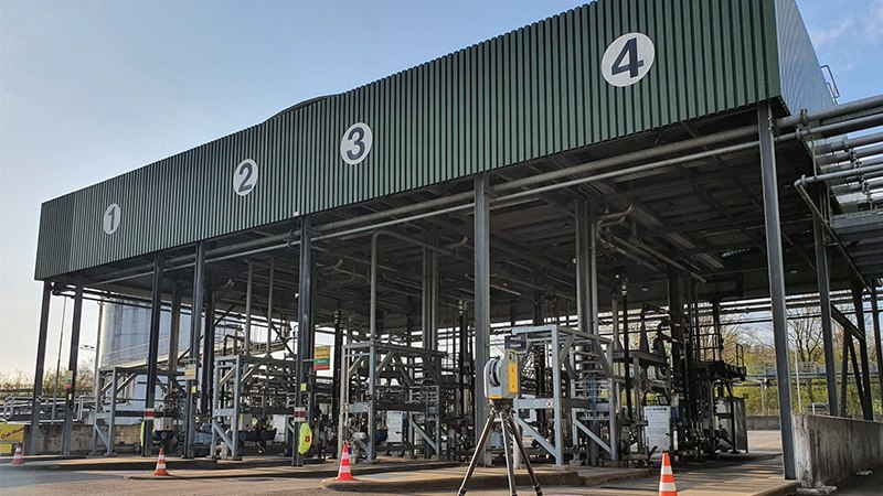
- 3D Process Models
Detailed representations of plantrooms and mechanical spaces, supporting retrofit planning, design validation, and asset documentation.
- 2D CAD Drafting
Clear, layered 2D drawings generated from laser scans, including layouts, elevations, and sections – formatted for AutoCAD and easy integration.
- Floor Plans
Precise as-built plans for space planning, lease area calculations, and design reference, tailored to RICS and architectural standards.
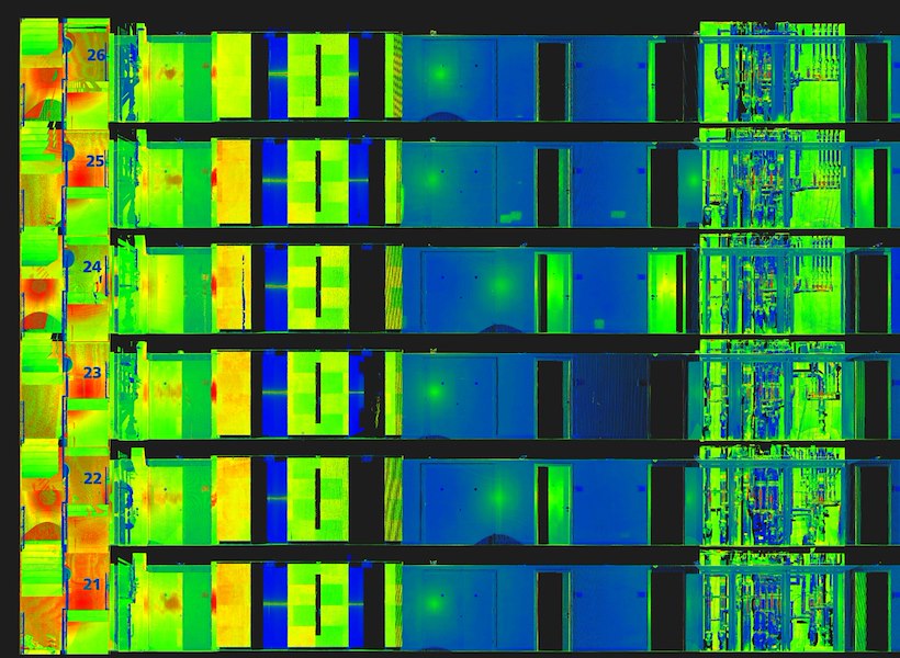
- Measured Elevation Drawings
High-detail elevation surveys for building facades, created from scan data to support planning applications, refurbishments, and heritage works.
- Floor Flatness and Floor Level Analysis
Detailed surface level reports highlighting deviations, slopes, and high/low spots – ideal for flooring upgrades and drainage planning.
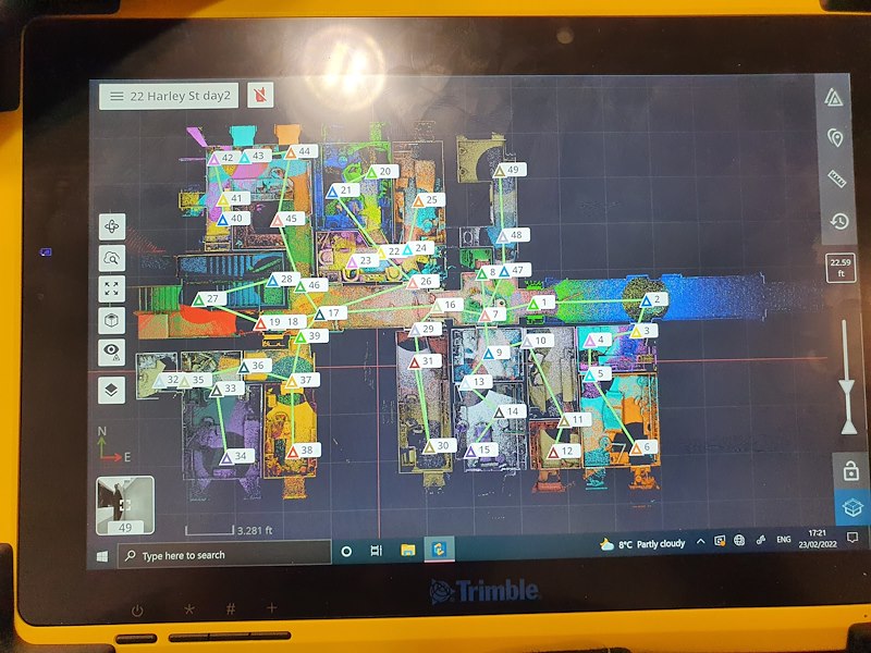
- Virtual Site Tours
Interactive panoramic walkthroughs linked to point cloud data, allowing off-site teams to view, measure, and coordinate remotely.
Neonex Digital Ltd.
5
out of 5
based on 4 ratings.
Reviews & Testimonials for Neonex Digital Ltd

Lewis' vast knowledge and experience, together with positive can do attitude and drive towards solving problems to meet our requirements has meant that we've continued to work together on many projects that have led to many tangible improvements to our site practices and procedures.
May 07, 2025
Testimonial by
R.H - London
Testimonial by
R.H - London
We have found Lewis and his team to be proactive and flexible in their scanning activities, often requiring the accessing of awkward areas and the spatial linking together of dispersed modelled areas. The resulting 3d Models produced by Lewis and his team have been comprehensive and accurate, and delivered within reasonable timescales. We have also found the depository of scanned image data being accessible in a navigable webportal (Cintoo) Model a very useful tool in developing and planning our works, reducing the need to make further site survey return visits by the designers.
March 13, 2025
Testimonial by
P.C - Nottingham
Testimonial by
P.C - Nottingham
By using the point cloud data captured by Lewis and his team, we were able to take accurate measurements for cladding replacement across five buildings without the need for scaffolding, saving both time and cost while improving site safety.
February 17, 2025
Testimonial by
A.O
Testimonial by
A.O
The final models looked great and were delivered with clear file naming and a Navisworks export, which made coordination much easier. We really appreciated the extra effort, especially over the weekend.
December 20, 2024
Testimonial by
K.S - Cambridge
Testimonial by
K.S - Cambridge
Gallery
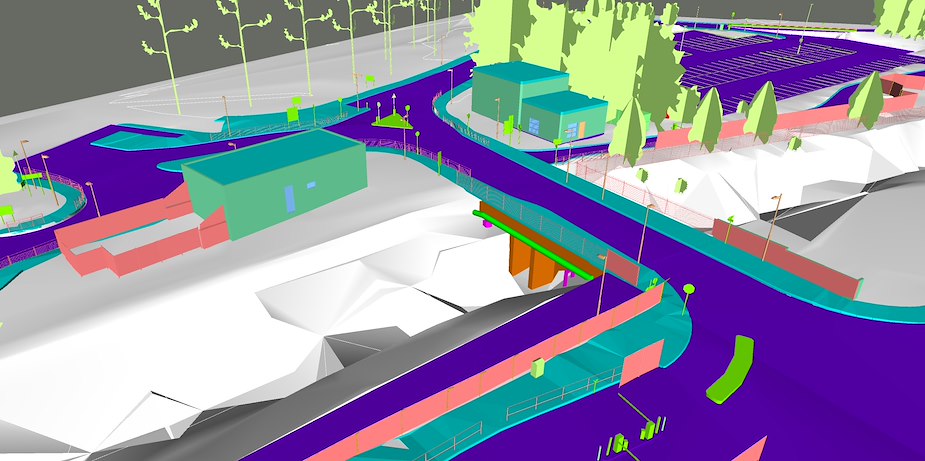

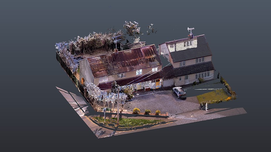

Drone Survey of a Building Roof
Videos
Products & Services
Location Map
Neonex Digital Ltd Serves The Following Areas
Neonex Digital Ltd Serves The Following Boroughs
Find Neonex Digital Ltd in