London
 UK
UK Ireland
 Scotland

South West Surveys
Address
Unit 2, The Cartshed, Manor Farm Offices,
Aust Road, Aust,
Aust Road, Aust,
South Gloucestershire
BS35 4AT
Land surveyors in Gloucestershire
About South West Surveys
Surveying Services For Every Application
At South West Surveys we travel throughout the UK delivering fast, effective, highly detailed and accurate surveys. Our staff have a minimum of 15 years experience using Trimble robotic total stations, GPS and Faro 3D laser scanners, along with the latest data collection technologies available. Our client’s requirements are paramount, therefore we are happy to tailor our services to suit your individual needs or simply use a predetermined specification.
A large number of our projects are based in the South West, Wales and M4 Corridor and across the Midlands. We do however work with a number of larger clients on projects across the United Kingdom.
Our Comprehensive Surveying Services
We specialise in producing as-built 3D models for BIM and visualisation purposes. Our expertise includes modelling, commercial properties, residential properties, pump houses, complete with pipework, and laser scanning listed statues to convert them into solid mesh models for replication.
We proudly collaborate with architects, town planners, consulting engineers, surveyors, and private clients, offering specialist surveying services tailored to your specific needs.
At South West Surveys, we utilise advanced Trimble robotic total stations, GPS surveying equipment, UAVs (photogrammetry & LIDAR) and 3D laser scanners to deliver high-precision and detailed surveys.
Our team is dedicated to providing exceptional service, ensuring all surveys are competitively priced and delivered on time. Whether you need predetermined specification or a tailored solution, we are here to meet your requirements.
The team at South West Surveys look forward to partnering with you on your next project.
Topographic Survey
South West Surveys are based in Bristol and travel throughout the UK offering highly detailed and precise surveys to every sector at affordable prices.
Our surveys will record every detail of the site, whether it be natural or manmade features.
Our surveys are delivered in PDF & DWG files and can be produced in 2D or 3D.
Measured Building Surveys
At South West Surveys, we specialise in providing comprehensive measured building surveys adhering to the RICS measured building survey specification. We combine traditional surveying techniques with modern technology, enabling surveyors to create highly precise and detailed floor plans, sections, and elevations of existing buildings and structures.
If you are interested in learning more about measured building surveys, please read our “Ultimate Guide to Measured Building Surveys”.
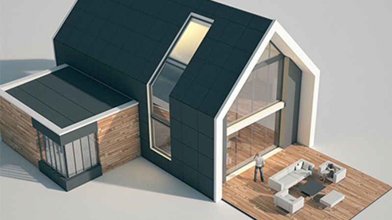
BIM Surveys & 3D Modelling
We can offer a full in-house 3D modelling/BIM service.
Models can be produced from 3D point clouds or 2D drawings. These can be supplied to us or we can visit your site and deliver a full service from the initial site survey right through to the final 3D model.
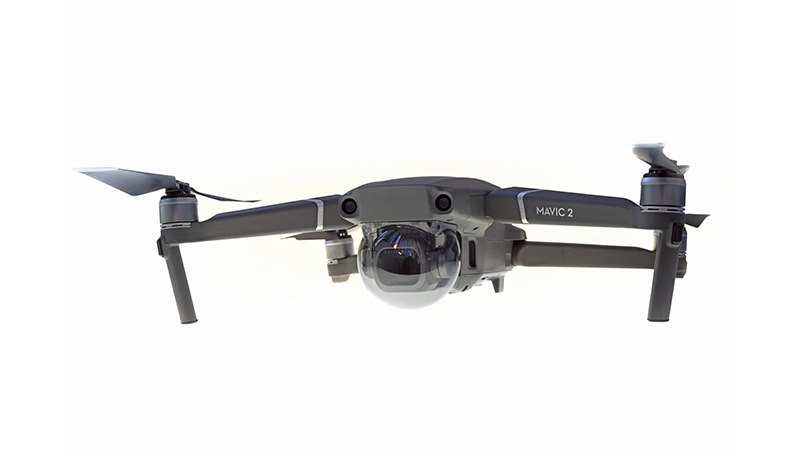
Drone Surveying
At South West Surveys, we operate our own in-house drone operations with fully insured, CAA-approved pilots. Our advanced drone surveys offer unparalleled data collection capabilities, reaching areas that are otherwise inaccessible or pose high risks, such as railways, motorways, dilapidated structures, or small islands.
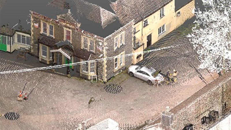
Laser Scanning Survey
At South West Surveys, we specialise in providing precise and comprehensive laser scanning surveys for a wide range of projects.
Our expertise in terrestrial laser scanning ensures that we deliver the most accurate point cloud data for your project’s needs.
Mobile Mapping
High-Precision LiDAR Surveys Across the UK. At South West Surveys, we specialise in advanced mobile mapping and LiDAR (Light Detection and Ranging) services for clients throughout the UK. Leveraging cutting-edge technology, including multi-rotor drones and vehicle-mounted sensors, we deliver precise and efficient survey solutions tailored to your needs.
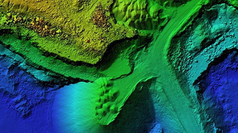
Bathymetry Survey
South West Surveys offer bathymetry surveys for customers across the UK.
We use a multitude of data collection methods to produce the best possible results, these range from total stations, GPS, LIDAR & USV (unmanned surface vehicles) to multibeam echosounders.
Using these specialist surveying equipment, we can accurately plot the positions of watercourses, watercourse structures and nearby topographic detail.
Utility Surveys
At South West Surveys, we specialise in utility surveys for clients across the UK. Our comprehensive utility mapping services help you identify underground utilities, ensuring accurate and reliable data for your project.
Gallery


Location Map
South West Surveys Serves The Following Areas
South West Surveys Serves The Following Boroughs